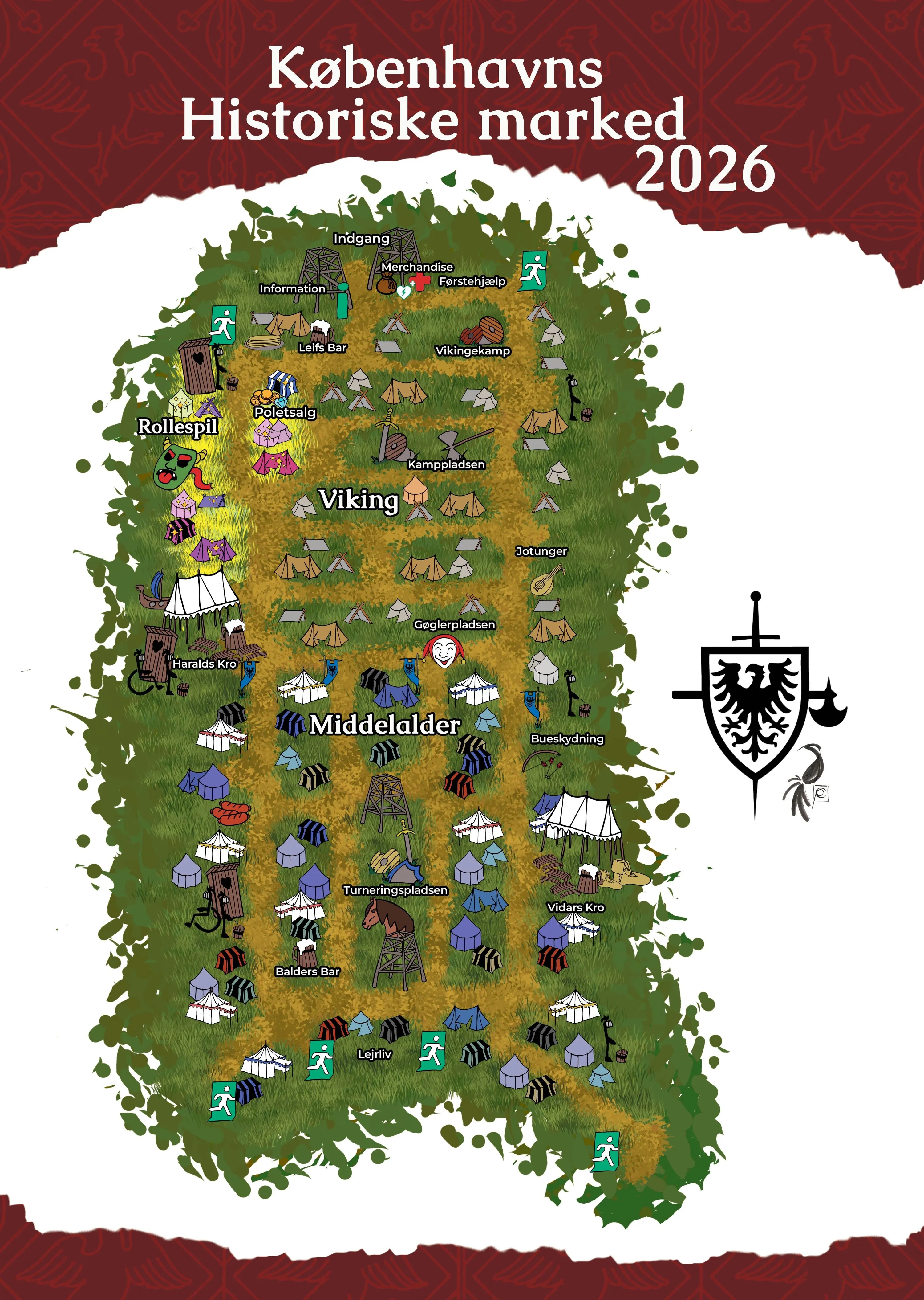
Illustrated overview map of Copenhagen Historical Market 2026, labelled in Danish. At the top: entrance (Indgang), information, merchandise and first aid (Førstehjælp). The Viking area with Leifs Bar, token sales (Poletsalg), Viking combat (Vikingekamp), the battlefield (Kamppladsen) and Jotunger; roleplay (Rollespil) on the left; Gøglerpladsen, the jugglers’ square, in the middle; the medieval area with Haralds Kro, archery (Bueskydning), the tournament ground (Turneringspladsen), Vidars Kro and Balders Bar; camp life (Lejrliv) at the bottom. Toilets, accessible toilets and emergency exits are marked around the site.
Overview map 2026 (labels in Danish – see the key places below).

The map in brief

What you’ll find on site

By the entrance

  • Information
  • Merchandise
  • First aid (Førstehjælp)
  • Token sales (Poletsalg) nearby

The Viking area

  • Viking combat and the battlefield (Kamppladsen)
  • Leifs Bar
  • Roleplay (Rollespil)
  • Gøglerpladsen, the jugglers’ square

The medieval area

  • The tournament ground (Turneringspladsen)
  • Archery (Bueskydning)
  • Haralds Kro, Vidars Kro and Balders Bar
  • Camp life (Lejrliv)
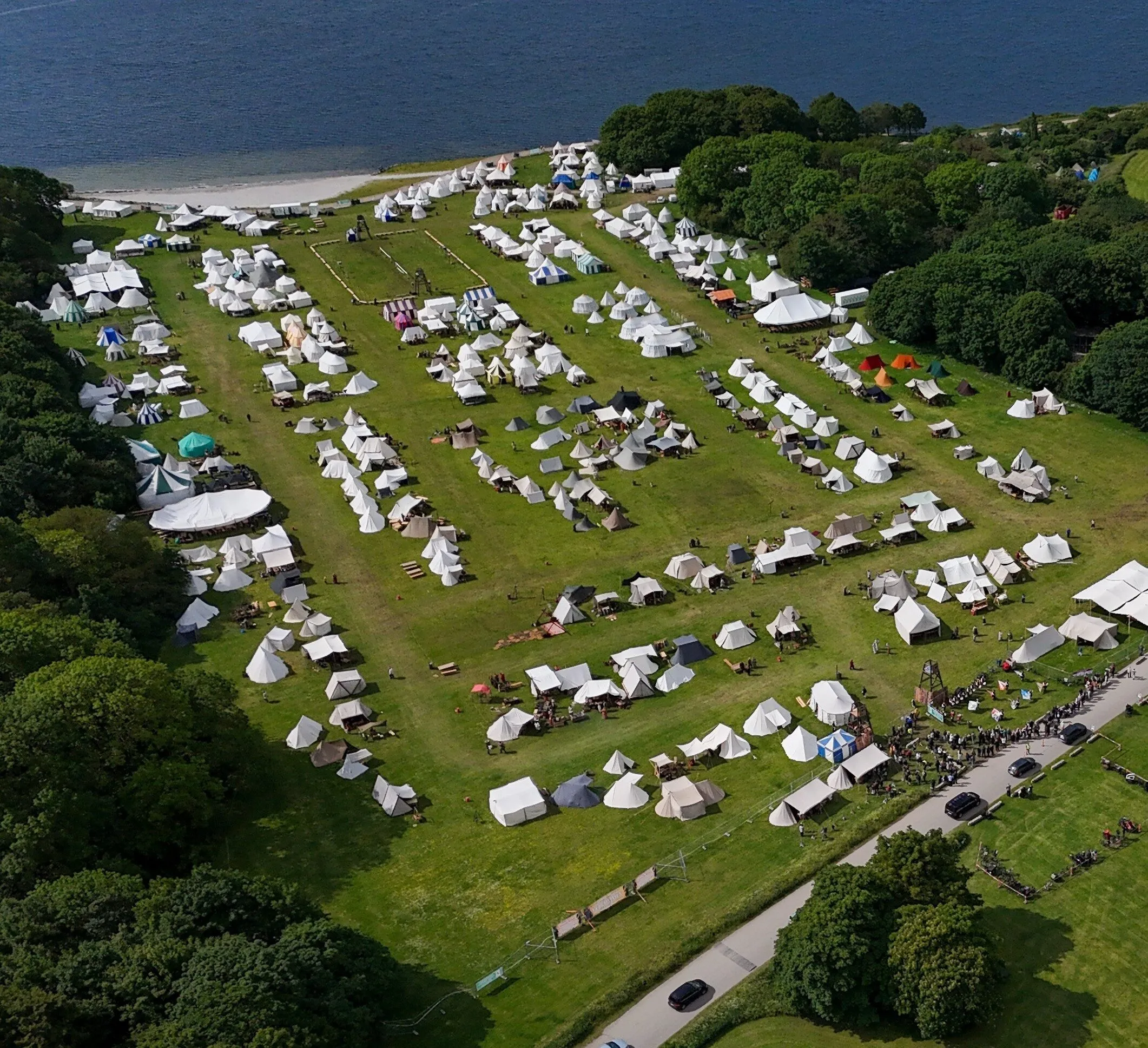
Drone photo of the market site in Valbyparken, with rows of white and striped tents on the lawn, the tournament ground in the middle, woodland on both sides and the water in the background
The market site from the air in 2025.